 Detourmap
Places worth the detour in Alabama
Detourmap lists 29 places in Alabama, United States, across 2 kinds of detour. Best known: Gantts Quarry. 27 rank as little-known. Click any card to open it on the map.
- Places
- 29
- Oldest
- Apalachicola Fort Site 1690
- Little known
- 27 of 29
- Share of United States
- 1%
Alabama 29
All 29, best known first.
-
2.Cahaba
Archaeological · 19th century · Notable
Former capital of the U.S. state of Alabama and seat of Dallas County
-
3.Horseshoe Bend National Military Park
Archaeological · 20th century · Hidden gem
2,040-acre park in Alabama (US) maintained by the National Park Service
-
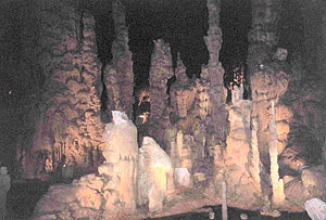
7.Rickwood Caverns State Park
Nature · Hidden gem
State park in Blount County, Alabama, United States
-
8.Fort Charlotte
Archaeological · 18th century · Hidden gem
Partially-reconstructed 18th century fort in Alabama, United States; site of a Spanish victory in the American Revolutionary War (March 14, 1780)
-
10.Cathedral Caverns State Park
Nature · 20th century · Hidden gem
State park of a state of the United States
-
14.Blakeley
Archaeological · 19th century · Hidden gem
Human settlement in Alabama, United States of America
-
22.Arlington Antebellum Home & Gardens
Archaeological · 19th century · Hidden gem
Historic house museum in Birmingham, AL, USA
-
26.Sulphur Trestle Fort Site
Archaeological · Hidden gem
Historic archaeological site in Alabama, United States






Elsewhere in United States
Questions about this page
What is the best known place worth the detour in Alabama?
Gantts Quarry. Ghost town in Talladega County, Alabama, United States. It leads because more Wikipedia language editions cover it than any other place here.
How many places worth the detour are there in Alabama?
29: 21 archaeological & historic sites and 8 nature & landscapes. 27 of them are little known — they carry a Wikipedia article in only a handful of languages.
What is the oldest place on this map in Alabama?
Apalachicola Fort Site, dated to 1690. 9 of the 29 places here carry a founding date at all.
What counts as Alabama here?
Wikidata's own administrative boundary: a place is in Alabama if its located in the administrative territorial entity chain leads there. Alabama is a first-level division of United States, the same level as a state or a province.
Where does this information come from?
Every place is drawn from Wikidata (CC0), with photographs from Wikimedia Commons and a link to its English Wikipedia article. Selection is deterministic: a place is here because Wikidata files it under one of the classes this atlas carries and it has coordinates, a photo and an article. Nothing is written or chosen by an AI, and the ranking is simply how many Wikipedia language editions cover a place.