 Detourmap
Places worth the detour in Arizona
Detourmap lists 144 places in Arizona, United States, across 2 kinds of detour. Best known: Grand Canyon. 122 rank as little-known. Click any card to open it on the map.
- Places
- 144
- Oldest
- Guevavi Mission 1701
- Little known
- 122 of 144
- Share of United States
- 4%
Arizona 144
The 120 best known of 144. The other 24 are on the map and on the United States pages.
-
1.Grand Canyon
Nature · Iconic
Steep-sided canyon carved by the Colorado River in Arizona, United States
-
2.Grand Canyon National Park
Nature · 20th century · Renowned
National park in Coconino and Mohave counties in Arizona, United States
-
3.Petrified Forest National Park
Nature · 20th century · Renowned
National park of the United States
-
6.Saguaro National Park
Nature · 20th century · Notable
United States National Park, in the state of Arizona
-
7.Lake Mead
Nature · 20th century · Notable
Reservoir on the Colorado River, Nevada and Arizona in the United States
-
11.Canyon de Chelly National Monument
Archaeological · 20th century · Notable
National monument in Apache County, Arizona
-
16.The Wave
Nature · Notable
Rock formation in the Vermilion Cliffs National Monument in Conconino, Arizona, United States
-
17.Mount Graham
Nature · Notable
Mountain in the Pinaleño Mountains in Graham County, Arizona, United States
-
18.Organ Pipe Cactus National Monument
Nature · 20th century · Notable
United States National Monument In Arizona
-
23.Black Canyon of the Colorado
Nature · Hidden gem
Canyon on the Colorado River where Hoover Dam was built
-
24.Walnut Canyon National Monument
Archaeological · 20th century · Hidden gem
United States National Monument in Arizona
-
31.Marble Canyon
Nature · Hidden gem
Section of the Colorado River canyon from Lee's Ferry to the confluence with the Little Colorado River
-
33.Kartchner Caverns State Park
Nature · 20th century · Hidden gem
State park in the US state of Arizona
-
34.Awatovi Ruins
Archaeological · Hidden gem
National Historic Landmark in Navajo County, Arizona, United States
-
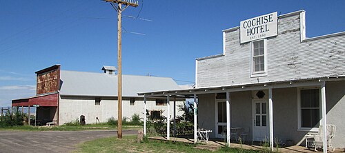
35.Fairbank
Archaeological · 19th century · Hidden gem
Ghost town in Cochise County, Arizona, United States
-
36.Oak Creek Canyon
Nature · Hidden gem
River gorge located in northern Arizona between the cities of Flagstaff and Sedona
-
38.Madera Canyon
Archaeological · Hidden gem
Canyon in the northwestern face of the Santa Rita Mountains in Pima and Santa Cruz counties in Arizona, United States
-
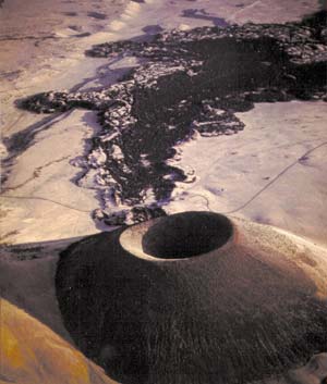
42.Darling Cinder Pit
Archaeological · Hidden gem
Cinder pit mine in Coconino County, Arizona, United States
-
45.Homolovi State Park
Archaeological · 20th century · Hidden gem
Protected area in Navajo County, Arizona, US
-
53.Buenos Aires National Wildlife Refuge
Nature · 20th century · Hidden gem
Protected area in Pima County, Arizona
-
55.Skeleton Canyon
Nature · Hidden gem
Landform located 30 miles (50 km) northeast of the town of Douglas, Arizona
-
75.Molino Canyon
Nature · Hidden gem
Canyon in the Santa Catalina Mountains northeast of Tucson, Arizona
-
77.Cottonwood Valley
Nature · Hidden gem
Valley in Clark County, Nevada and Mohave County, Arizona in the United States
-
84.Newspaper Rock Petroglyphs Archeological District
Archaeological · Hidden gem
United States historic place in Apache County, Arizona
-
87.Mesa Grande
Archaeological · Hidden gem
Cultural park in Mesa, Arizona, preserving a group of Hohokam structures
-
89.Painted Rock Petroglyph Site
Archaeological · Hidden gem
Archaeological site in Arizona, United States
-
90.Tumacácori Mission
Archaeological · 18th century · Hidden gem
Historic mission ruins in Arizona, United States
-
91.Guevavi Mission
Archaeological · 18th century · Hidden gem
Historic mission ruins in Arizona, USA
-
92.Calabazas Mission
Archaeological · 18th century · Hidden gem
Historic mission ruins in Arizona, USA
-
93.Murray Springs Clovis Site
Archaeological · Hidden gem
Archaeological site in the United States of America
-
94.Presidio Santa Cruz de Terrenate
Archaeological · 18th century · Hidden gem
New Spanish XVIII century fort in Cochise County, Arizona, United States
-
95.Tubac Presidio
Archaeological · 18th century · Hidden gem
New Spanish XVIII century fort in Arizona, USA
-
101.Contention City
Archaeological · 19th century · Hidden gem
Ghost town in Cochise County, Arizona
-
106.Gillett
Archaeological · 19th century · Hidden gem
Ghost town in Yavapai County, Arizona, United States
-
107.Kentucky Camp
Archaeological · 20th century · Hidden gem
Human settlement in Arizona, United States of America
-
110.Rucker Canyon
Nature · Hidden gem
Major canyon draining the western central-south of the Chiricahua Mountains
-
111.Sabino Canyon
Nature · Hidden gem
A significant canyon located in the Santa Catalina Mountains and the Coronado National Forest
-
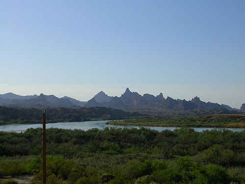
113.The Needles
Nature · Hidden gem
Rock formation in the Havasu National Wildlife Refuge in Mohave County, Arizona, United States
-
115.Congress Mine
Archaeological · Hidden gem
Mine in Arizona, United States of America, United States of America
-
117.Grand Falls
Nature · Hidden gem
A natural waterfall system situated in Arizona that is also dubbed 'Chocolate Falls' due to its distinctive colour.
-
119.Deer Valley Petroglyph Preserve
Archaeological · Hidden gem
United States historic place in Maricopa County, Arizona
-
120.Hunt's Tomb
Archaeological · 20th century · Hidden gem
Tomb of former governor of Arizona, United States
















Elsewhere in United States
Questions about this page
What is the best known place worth the detour in Arizona?
Grand Canyon. Steep-sided canyon carved by the Colorado River in Arizona, United States. It leads because more Wikipedia language editions cover it than any other place here.
How many places worth the detour are there in Arizona?
144: 84 archaeological & historic sites and 60 nature & landscapes. 122 of them are little known — they carry a Wikipedia article in only a handful of languages.
What is the oldest place on this map in Arizona?
Guevavi Mission, dated to 1701. 35 of the 144 places here carry a founding date at all.
What counts as Arizona here?
Wikidata's own administrative boundary: a place is in Arizona if its located in the administrative territorial entity chain leads there. Arizona is a first-level division of United States, the same level as a state or a province.
Where does this information come from?
Every place is drawn from Wikidata (CC0), with photographs from Wikimedia Commons and a link to its English Wikipedia article. Selection is deterministic: a place is here because Wikidata files it under one of the classes this atlas carries and it has coordinates, a photo and an article. Nothing is written or chosen by an AI, and the ranking is simply how many Wikipedia language editions cover a place.