 Detourmap
Places worth the detour in Washington
Detourmap lists 258 places in Washington, United States, across 2 kinds of detour. Best known: Mount St. Helens. 226 rank as little-known. Click any card to open it on the map.
- Places
- 258
- Oldest
- Mount Rainier National Park 1899
- Little known
- 226 of 258
- Share of United States
- 6%
Washington 258
The 120 best known of 258. The other 138 are on the map and on the United States pages.
-
3.Olympic National Park
Nature · 20th century · Renowned
National park on the Olympic Peninsula in Washington State, USA
-
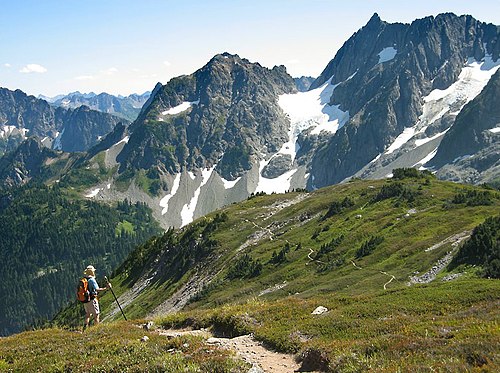
6.North Cascades National Park
Nature · 20th century · Notable
U.S. National Park located in the state of Washington
-
10.Mount Olympus
Nature · Notable
Mountain in the Olympic Mountains in Jefferson County, Washington, United States
-
14.Hanford
Archaeological · 20th century · Notable
Ghost town in Benton County, Washington, United States
-
16.Columbia River Gorge
Nature · Notable
Canyon along the border of Oregon and Washington in the United States
-
18.Lopez Island
Nature · Notable
Island of the San Juan Islands in San Juan County, Washington, United States of America
-
23.Tacoma Narrows Bridge
Archaeological · 20th century · Notable
Suspension bridge that collapsed in 1940
-
24.Mount Constance
Nature · Notable
Mountain in Jefferson County, Washington state, United States of America
-
25.Mount Stuart
Nature · Notable
Mountain in the Alpine Lakes Wilderness, Washington state, United States of America
-
28.Cape Alava
Nature · Notable
Cape on the Olympic Coast in Clallam County, Washington, United States of America
-
30.Comet Falls
Nature · Notable
Waterfall on Van Trump Creek in Mount Rainier National Park, Washington
-
32.Mount Daniel
Nature · Notable
Mountain in the Alpine Lakes Wilderness, Washington state, United States of America
-
33.Lake Crescent
Nature · Hidden gem
Lake in Clallam County, Washington state, United States of America
-
34.Lake Sammamish
Nature · Hidden gem
Lake in King County, Washington state, United States of America
-
36.Decatur Island
Nature · Hidden gem
Island of the San Juan Islands in Washington state, United States
-
38.Snoqualmie Falls
Nature · Hidden gem
Waterfall on the Snoqualmie River in Washington state, United States
-
42.Seven Fingered Jack
Nature · Hidden gem
Mountain in Chelan County, Washington state, United States of America
-
44.Argonaut Peak
Nature · Hidden gem
Mountain in the Alpine Lakes Wilderness, Washington state, United States of America
-
46.Mount Pilchuck
Nature · Hidden gem
Mountain in Snohomish County, Washington state, United States of America
-
48.Lake Quinault
Nature · Hidden gem
Lake in Grays Harbor County, Washington state, United States of America
-
51.Fidalgo Island
Nature · Hidden gem
Island of Puget Sound in Skagit County, Washington, United States of America
-
52.Hood Canal
Nature · Hidden gem
Fjord off of Puget Sound in Washington state, United States of America
-
53.Grays Harbor
Nature · Hidden gem
Estuary and bay of the Pacific Ocean in Grays Harbor County, Washington, United States of America
-
61.Mount Ellinor
Nature · Hidden gem
Mountain in Mason County, Washington state, United States of America
-
67.Mount Terror
Nature · Hidden gem
Mountain in Whatcom County, Washington, United States of America
-
68.Osoyoos Lake
Nature · Hidden gem
Lake in Washington state, United States of America and British Columbia, Canada
-
69.Maury Island
Nature · Hidden gem
Island of Puget Sound in King County, Washington state, United States of America
-
70.Alki Point
Nature · Hidden gem
Cape of Puget Sound in Seattle, Washington, United States of America
-
72.Kettle Falls
Nature · Hidden gem
Submerged waterfall on the Columbia River in Washington, United States
-
79.Franklin Falls
Nature · Hidden gem
Waterfall n the South fork of the Snoqualmie River in Washington State, USA
-
81.Columbia Glacier
Nature · Hidden gem
Glacier on Columbia Peak in Snohomish County, Washington state, United States of America
-
83.Wallula Gap
Nature · Hidden gem
Large water gap of the Columbia River through basalt anticlines in the U.S. state of Washington
-
84.Deception Pass
Nature · Hidden gem
Strait between Whidbey and Fidalgo Islands on Puget Sound, Washington, United States of America
-
85.Admiralty Inlet
Nature · Hidden gem
Strait that connects the Strait of Juan de Fuca to Puget Sound in Washington State, USA
-
93.Whitman Mission National Historic Site
Archaeological · 20th century · Hidden gem
National Historic Site of the United States
-
95.Olympic Coast National Marine Sanctuary
Nature · 20th century · Hidden gem
Marine protected area in Washington state, USA
-
103.Willapa Bay
Nature · Hidden gem
Bay and estuary on the Pacific coast of southwest Washington, USA.
-
104.Shilshole Bay
Nature · Hidden gem
Bay of Puget Sound west of Ballard, Seattle, Washington, United States of America
-
116.Govan
Archaeological · Hidden gem
Unincorporated community and ghost town in Washington, United States
-
118.Dungeness National Wildlife Refuge
Nature · Hidden gem
Federally protected wildlife refuge in Clallam County, Washington, United States of America
-
119.Billy Frank Jr. Nisqually National Wildlife Refuge
Nature · 20th century · Hidden gem
Federal wildlife refuge in the Nisqually River estuary, Washington, United States












Elsewhere in United States
Questions about this page
What is the best known place worth the detour in Washington?
Mount St. Helens. Volcano in Washington state. It leads because more Wikipedia language editions cover it than any other place here.
How many places worth the detour are there in Washington?
258: 229 nature & landscapes and 29 archaeological & historic sites. 226 of them are little known — they carry a Wikipedia article in only a handful of languages.
What is the oldest place on this map in Washington?
Mount Rainier National Park, dated to 1899. 22 of the 258 places here carry a founding date at all.
What counts as Washington here?
Wikidata's own administrative boundary: a place is in Washington if its located in the administrative territorial entity chain leads there. Washington is a first-level division of United States, the same level as a state or a province.
Where does this information come from?
Every place is drawn from Wikidata (CC0), with photographs from Wikimedia Commons and a link to its English Wikipedia article. Selection is deterministic: a place is here because Wikidata files it under one of the classes this atlas carries and it has coordinates, a photo and an article. Nothing is written or chosen by an AI, and the ranking is simply how many Wikipedia language editions cover a place.