 Detourmap
 City in Jordan
Places worth the detour in Amman
15 places worth going out of your way for lie within 30 km of Amman, Jordan, across 2 kinds of detour; archaeological & historic sites are the largest group (13). Best known: Mount Nebo. 9 of them rank as little-known. Click any card to open it on the map.
- Within 30 km
- 15
- Oldest
- Ayn Ghazal 7300 BC
- Little known
- 9 of 15
- Most from
- 8th millennium BC

All 15, ranked 15
Ranked by how many Wikipedia editions cover them.
- 1
 NaturePhoto · Berthold Werner · CC BY 3.0
- 2
 ArchaeologicalPhoto · Jeanhousen · CC BY-SA 3.0
- 3
 ArchaeologicalPhoto · Bashar Tabbah · CC BY-SA 4.0
- 4
 ArchaeologicalPhoto · David Bjorgen · CC BY 2.5
- 5
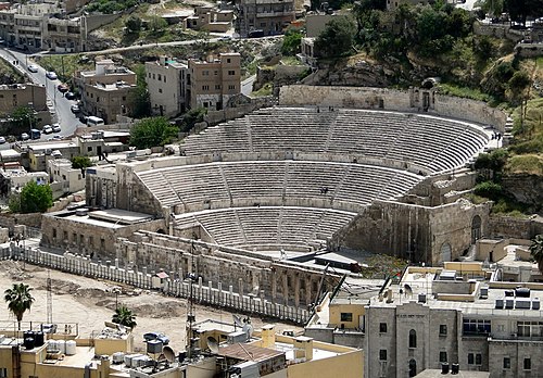 ArchaeologicalPhoto · Bernard Gagnon · CC BY-SA 4.0
- 6
 ArchaeologicalPhoto · لا روسا · CC BY-SA 3.0
- 7
 ArchaeologicalPhoto · Ken and Nyetta · CC BY 2.0
- 8
 CavePhoto · JoTB · CC BY-SA 3.0
- 9
 ArchaeologicalPhoto · Freedom's Falcon · CC BY-SA 4.0
- 10ArchaeologicalPhoto · Bernard Gagnon · CC BY-SA 4.0
- 11
 ArchaeologicalPhoto · Bashar Tabbah · CC BY-SA 4.0
- 12
 Macabre sitePhoto · Eduard Marmet · CC BY-SA 3.0
- 13
 ArchaeologicalPhoto · Bashar Tabbah · CC BY-SA 4.0
- 14
 ArchaeologicalPhoto · Mohammad hajeer · CC BY-SA 4.0
- 15
 ArchaeologicalPhoto · Yazan Al-Hajjaj · CC BY-SA 3.0Khirbet Yajouz archaeological siteJordan · Hidden gem
Archaeological site in Greater Amman Municipality, Jordan
Within reach of Amman


 105 places


Questions about this page
What is worth seeing near Amman?
15 places within 30 km: 13 archaeological & historic sites and 2 nature & landscapes. The best known is Mount Nebo.
Is there anything near Amman that most visitors miss?
9 of these 15 places rank as little known — they carry a Wikipedia article in only a handful of languages, which is usually the difference between a queue and an empty path. They are in the ranked list below, furthest down.
What is the oldest thing near Amman?
Ayn Ghazal, dated to 7300 BC.
How is the 30 km radius measured?
As the crow flies from the centre of Amman, not by driving time. A place inside the circle can still be a long way round by road, and the distance to each is on its card on the map.
Where does this information come from?
Every place is drawn from Wikidata (CC0), with photographs from Wikimedia Commons and a link to its English Wikipedia article. Selection is deterministic: a place is here because Wikidata files it under one of the classes this atlas carries and it has coordinates, a photo and an article. Nothing is written or chosen by an AI, and the ranking is simply how many Wikipedia language editions cover a place.