 Detourmap
Places worth the detour in Alberta
Detourmap lists 113 places in Alberta, Canada, across 2 kinds of detour. Best known: Banff National Park. 72 rank as little-known. Click any card to open it on the map.
- Places
- 113
- Oldest
- Banff National Park 1885
- Little known
- 72 of 113
- Share of Canada
- 13%
Alberta 113
All 113, best known first.
-
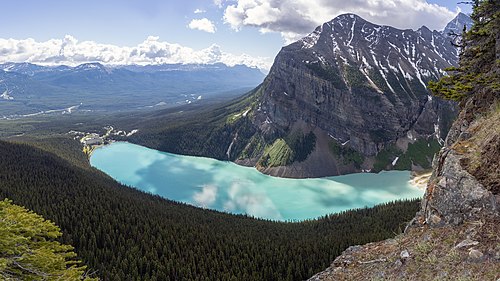
4.Jasper National Park
Nature · 20th century · Renowned
National park in the Canadian Rockies in Alberta, Canada
-
6.Head-Smashed-In Buffalo Jump
Nature · Notable
Buffalo jump located at the foothills of the Rocky Mountains in Canada
-
7.Waterton Lakes National Park
Nature · 19th century · Notable
National park in the southwest corner of Alberta, Canada
-
84.Cave and Basin National Historic Site
Nature · Hidden gem
Historic site in Banff National Park, Alberta, Canada
-
94.Strathcona Science Provincial Park
Archaeological · 20th century · Hidden gem
Provincial park in Alberta, Canada
-
109.Buffalo National Park
Nature · 20th century · Hidden gem
Former national park in Alberta, Canada
-
110.Siffleur Falls
Nature · Hidden gem
Series of waterfalls on the Siffleur River in Alberta, Canada
-
112.Lake Saskatoon
Archaeological · 20th century · Hidden gem
Formerly populated place in Alberta, Canada














Elsewhere in Canada
Questions about this page
What is the best known place worth the detour in Alberta?
Banff National Park, 19th century. National park in Alberta, Canada. It leads because more Wikipedia language editions cover it than any other place here.
How many places worth the detour are there in Alberta?
113: 103 nature & landscapes and 10 archaeological & historic sites. 72 of them are little known — they carry a Wikipedia article in only a handful of languages.
What is the oldest place on this map in Alberta?
Banff National Park, dated to 1885. 9 of the 113 places here carry a founding date at all.
What counts as Alberta here?
Wikidata's own administrative boundary: a place is in Alberta if its located in the administrative territorial entity chain leads there. Alberta is a first-level division of Canada, the same level as a state or a province.
Where does this information come from?
Every place is drawn from Wikidata (CC0), with photographs from Wikimedia Commons and a link to its English Wikipedia article. Selection is deterministic: a place is here because Wikidata files it under one of the classes this atlas carries and it has coordinates, a photo and an article. Nothing is written or chosen by an AI, and the ranking is simply how many Wikipedia language editions cover a place.